Sea crossing
Mainland
Corsica
(Extract from the SIA's Mainland – Corsica sea crossing leaflet)
During the summer holidays, you may be tempted to pop over to the Isle of Beauty. The classic “Mainland – Corsica” crossing, exciting as it is, nonetheless involves a number of difficulties that are best anticipated, whether in the airspace crossed on the mainland, the crossing itself or the arrival at Corsican airfields. The aim is not to discourage you, but to review the difficulties you may encounter so that you are well prepared.
It is important to remember that this crossing is relatively long.
Airspace
The Mediterranean coast is crowded with airports and aerodromes, civil airspace and military areas, which you should know about to avoid infringements. This tangle of airspace makes it harder to reach the sea crossing routes to Corsica. The SIA “Nice Côte d'Azur” 1:250,000 aeronautical chart gives a fairly complete overview of this airspace. With the supplement to aeronautical charts and the NOTAMs, you will have everything you need to plan your route to the start of the crossing. To help you manage your flight and find out about area activity, it is advisable to contact Marseille Information on 120.550 MHz, or the flight information services for your sector (Provence Info on 124.350 MHz, Nice Info on 124.425 / 120.850 MHz), even when flying in class G airspace.
R 138 (Canjuers): firing area from the surface to FL540. Easy to spot from the air thanks to its characteristic flatness in a hilly region, and its perimeter wall. This area must be avoided when active, preferably to the west.
R 50 (La Peyrière): firing area from the surface to 3,500 ft AMSL. Located south of Fayence, near Cannes reporting point WD, it is fairly recent and in class G airspace… Careful: it must be avoided!
The R 95 areas (Le Luc): large areas with variable vertical limits (from the surface to FL65) within which recommended routes are published or routings may be imposed by ATC. Beware of area 403 (parachuting), separate from the R 95s, whose upper limit is at least FL130 and which is very active at weekends and on public holidays.
LFTZ (La Mole): La Mole aerodrome is in class G airspace. It handles a lot of VFR and IFR traffic with very different performance (light aircraft, turboprops and jets, helicopters). Be very vigilant around this aerodrome.
R 232 (La Mole – St Tropez): area above La Mole aerodrome and the Saint-Tropez peninsula (from 2,100 ft to 3,500 ft). A transponder is compulsory inside this area. Traffic can be very dense here on several frequencies (La Mole traffic, Nice arrivals and departures, access to the sea crossing route to Corsica, …).
The “Marseille <–> ET” coastal transit: the recommended route passes very close to prohibited (P62, P63) and restricted (R60, national parks) areas. Be vigilant! The Nice TMA is divided into many separate sectors. The airspace classes are C, D and E. Vertical limits vary from the surface to FL195. Radio contact and a clearance are required before entering (classes C and D), as is a transponder. The controller may ask you to hold, to fly a heading or to fly at an IFR flight level to fit you into the traffic.
The crossing
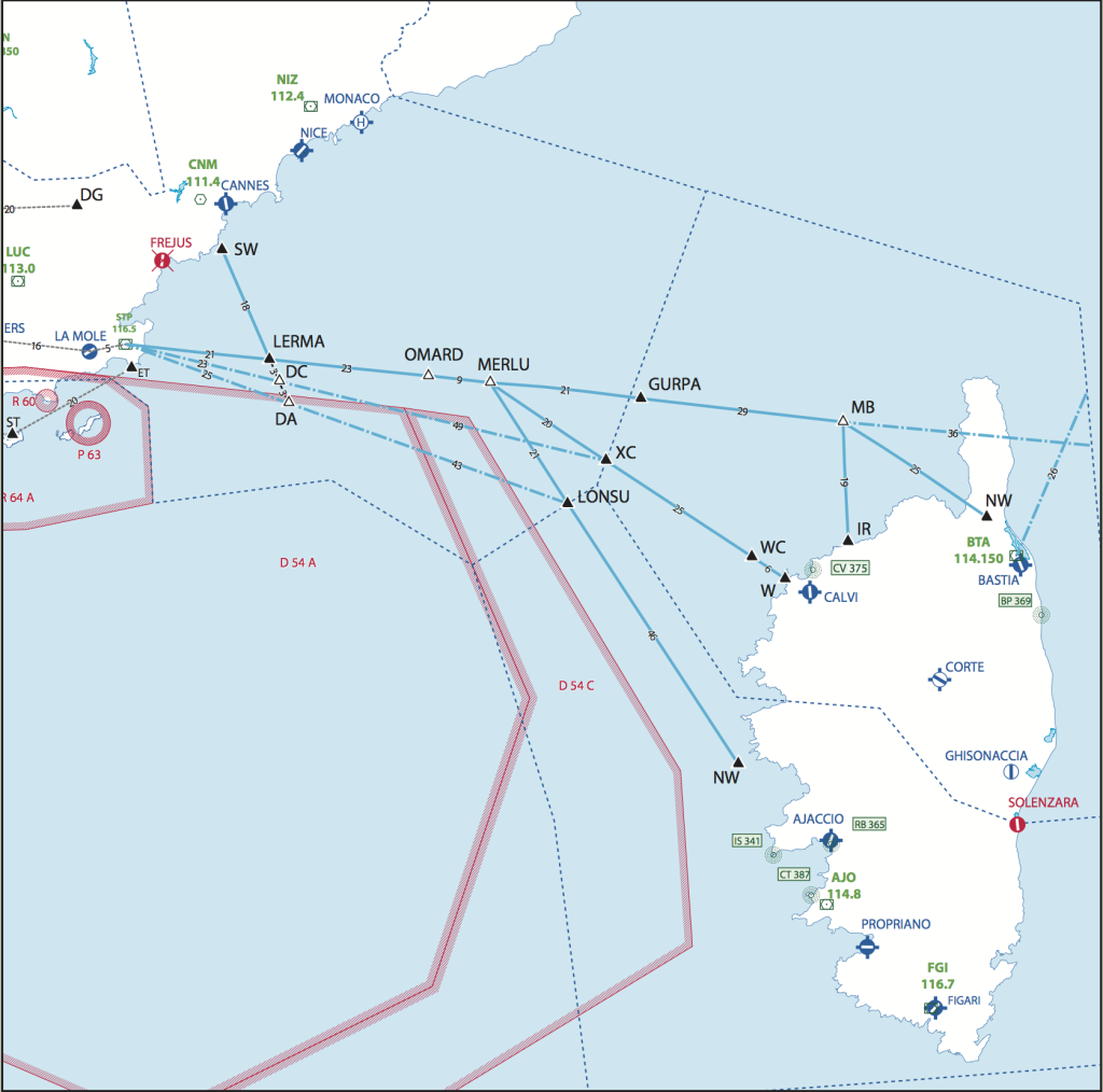
The crossing must follow one of the defined routes: “STP or SW of Cannes – LERMA – OMARD – MERLU”, then: “GURPA – MB – NW” to Bastia, “XC – WC – W” to Calvi, “LONSU – NW” to Ajaccio. Shortcuts may be used (via DC or DA) with clearance from Nice control, depending on D54 activity.
Requirements (SERA + PART NCO): a flight plan must be filed; life jackets must be carried; radio contact and continuous listening watch with the relevant FIS; position reports at the compulsory reporting points (LERMA, GURPA, XC, LONSU, MB, WC, NW, W).
Things to consider before departure: the regulations leave it to the pilot in command to decide whether to carry a life raft, with the following points to help decide: distance from a landing site, sea state and water temperature, etc.
Good practice
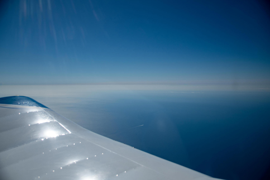
Recent training in flying without visual references with an instructor. Over the sea, the lack of visual references and possible sea haze can cause a loss of horizon reference. You may have to use the flight instruments to keep safely on your flight path.
– Make sure, through the pre-flight passenger briefing, that the evacuation procedure and the use of life jackets and the life raft are known and understood.
– Thorough flight planning and management. If you only use VORs, their range and accuracy will not always allow you to follow your flight path precisely. In that case, favour dead reckoning (heading, time). If you have GNSS, do not forget to check the waypoints entered in your system flight plan. If you have difficulties or are unsure of your position, do not hesitate to ask the flight information service for help – that is what it is there for!!! It will give you all the help you need to get back on track (suggested headings).
– Choose a high flight level. In the event of an engine failure, a higher altitude gives the crew more time to prepare for ditching. Know the relevant aircraft performance (best glide speed to cover the greatest distance / minimum sink speed to stay airborne as long as possible). Always keep in mind where the nearest coast is.
– Take careful account of the wind when planning your fuel. The region is prone to strong winds: carry enough fuel to turn back or divert on arrival. Corsican aerodromes are sensitive to wind, and also to sea fog.
– For carburettor aircraft, guard against carburettor icing. Over water the air mass can be particularly humid, and carburettor icing can occur even at moderate temperatures.
– Extend your lookout to the sea surface to spot any boats near your flight path.
Arriving in Corsica
Corsica is beautiful, but do not forget that it is mountainous. Watch out for the terrain! Do not relax after the crossing thinking your problems are over, because with fatigue setting in you may still run into real difficulties.
CALVI
An airfield known for its high terrain and difficult aerology. Hemmed in by mountains, it can be tricky when landing on runway 36 or going around on runway 18. In addition, the weather is often worse on arrival than during the crossing, because of sea haze.
Keep your eyes open!
A tourist airfield means a lot of traffic. First, remember there is no VOR at the airfield. The W – Calvi arrival axis is opposite to the departure paths (including some commercial flights). These crossings are made “visually”, in class E airspace, between 2,000 ft and FL95: keep your eyes open! Runway 36 can look deceptive to those unfamiliar with it (2% runway slope and a displaced threshold). With no taxiway and parking areas close to the runway, runway incursions are frequent: watch what others are doing. Finally, expect possible holding (especially at weekends) when traffic is heavy.
Diversion? For all these reasons, carry enough fuel for a possible diversion to Bastia, Ajaccio or even Figari. Also, work out your arrival time carefully. Night landings are not permitted at Calvi. To avoid problems from possible holding, diversions and sunset times, plan for example to arrive at Calvi before sunset minus 30 minutes.
BASTIA
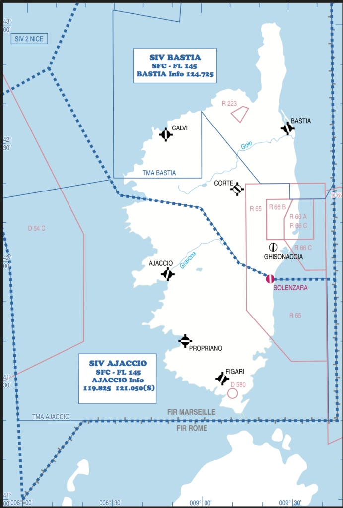
Located on a plain on the east side of the island, Bastia is an easy airfield for aircraft… once the mountains have been crossed! Beware of sometimes turbulent or stormy conditions when crossing the passes at NW and W. Note that paragliders regularly fly west-south-west of NW and on the slopes towards S, and that in general IFR traffic at the airport is heavier at weekends.
AJACCIO
Because IFR arrival and departure paths are close by and there is no radar coverage in the bay and neighbouring valleys, routes and transits and their associated altitudes must be strictly followed. Entry at point NW must be at 2,000 ft AMSL maximum. So remember to ask Ajaccio control for clearance if you wish to continue at a higher altitude.
In summary
– File a flight plan.
– Radio contact with the relevant FIS (Nice, Bastia or Ajaccio Information).
– Position reports at the specified points. Position report when crossing the FIS boundary. Every aircraft must carry one life jacket per person.
– Following the routes is compulsory. However, a direct route may be granted by ATC under radar surveillance.
– In VFR a transponder is compulsory in controlled airspace: check your equipment!